Walk a Wheeling Street Directory
A sound by-address search follows a fixed order because Wheeling records use different keys. The Ohio County Assessor supplies the present parcel, assessed owner, situs, and deed reference. GIS places that parcel among adjoining lots. The Ohio County Clerk then supplies recorded instruments. Voter and directory material can add evidence about a named person, but neither should be stretched into a complete household list.
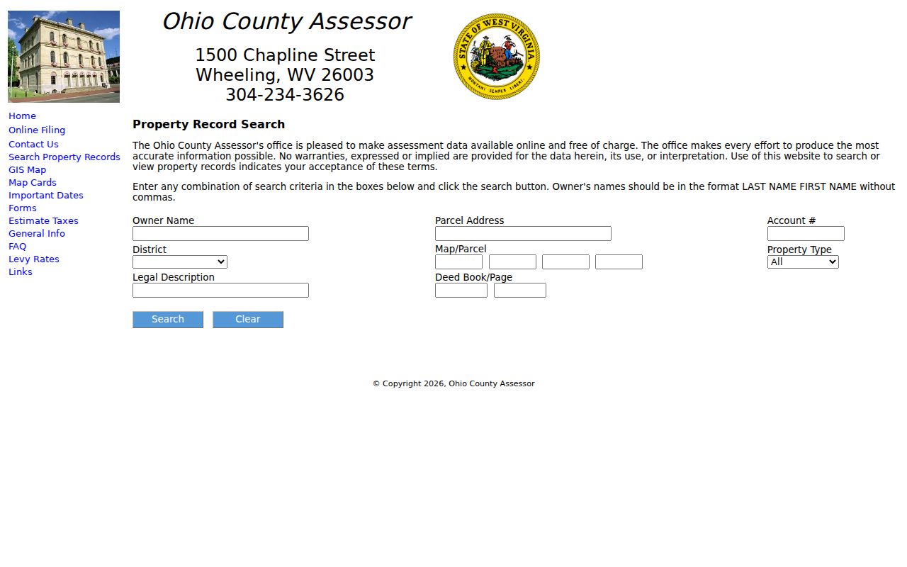
- Enter the street number and name in the Ohio County Assessor Property Search. Copy the situs, map and parcel, owner line, legal description, and deed book and page.
- Open the Ohio County GIS launch page. Select the target and nearby parcels one at a time rather than assuming house numbers follow parcel order.
- Use the owner name or deed reference in the Clerk's index. Treat each instrument by its actual role, since a lien or release is not a sale.
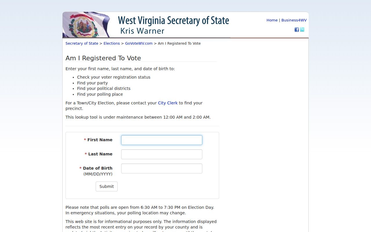
- Check a named voter only when a name and date of birth are known. The ordinary state form is not a browseable street roll.
- For an earlier occupant, search the reverse street section of a Wheeling city directory, then verify that finding against the parcel and deed trail.
This flow keeps the Wheeling street directory honest. It distinguishes assessed ownership, recorded title, registration, and directory occupancy instead of treating them as one master resident list.
Write down the date of every search. The assessor reflects an assessment cycle, a deed index reflects recorded documents, and a printed directory reflects its publication period. When sources disagree, check what each date means, then ask the keeper for the card, image, or file. This is vital on a long Wheeling street where similar names and repeated numbers can create a plausible but false match.
Search Wheeling Parcels by Address
The assessor says any combination of fields may be used. A parcel address is the direct street key, while a legal description or deed reference can rescue a search when spelling or numbering has shifted. Owner names are entered last name first, with no comma. The sample parcel card also shows that the portal separates the street location from the owner's mailing address.
| Portal field | Input | Street use |
|---|---|---|
| Owner Name | Optional text | Find a known tax owner |
| Parcel Address | Optional text | Search the physical address |
| Account Number | Optional text | Pivot from a tax record |
| District | Optional list | Narrow to the taxing district |
| Map/Parcel | Optional fields | Return to one exact parcel |
| Legal Description | Optional text | Bridge older lot wording |
| Deed Book/Page | Optional pair | Connect the parcel to the Clerk |
The portal is an assessment aid, not a certified title source. For a boundary, easement, or ownership conclusion, follow its book and page into the official deed or plat.
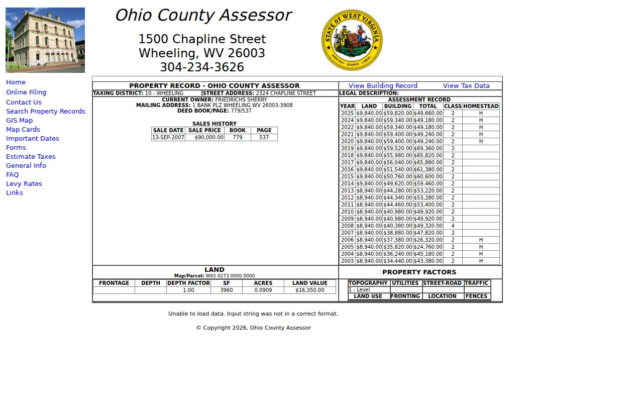
A returned card should be read field by field. The sample inspected in the research contained a Wheeling taxing district, street location, owner, separate mailing address, deed book and page, sale line, assessment rows, parcel number, and building and tax-data links. These connections enrich the street directory without making the card proof of residency.
The assessor's sample parcel card shows the result format used for this inventory.
Wheeling Street Record Terms
Four labels prevent many address errors. Read them as record types, not as interchangeable words for a home.
- Parcel
- A mapped unit used for assessment and record linking.
- Situs address
- The physical street location assigned to the parcel.
- Plat
- A recorded map showing lots, blocks, and boundaries.
- Criss-cross directory
- A directory arranged by street and number rather than only by surname.
A mailing address tells where tax mail goes. It may belong to a bank, trust, company, relative, or another address, so it cannot prove occupancy at the situs.
Map Wheeling Streets Parcel by Parcel
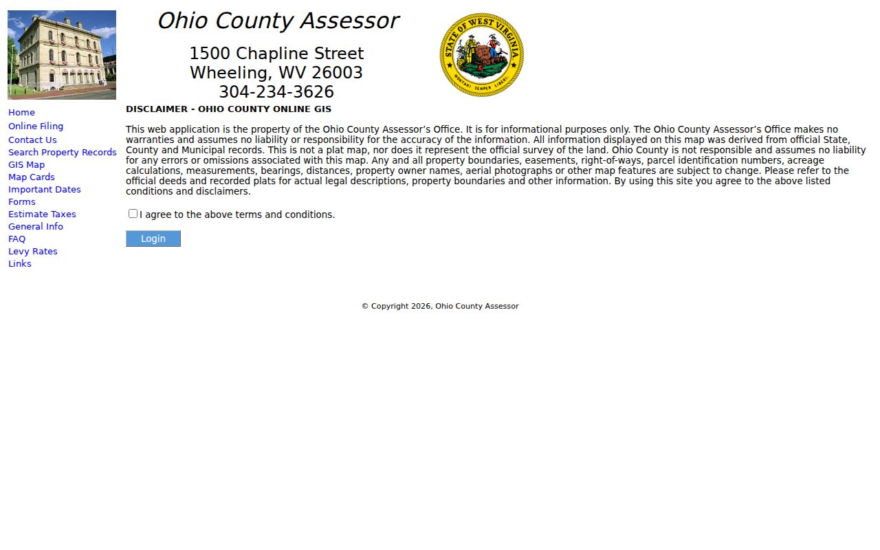
The GIS route begins with a disclaimer because its parcel lines are reference graphics, not a survey. Zoom to the target street, click a parcel, record its identifier and situs, and then open the matching assessor card. Repeat for each lot. Do not assume two sequential street numbers share a boundary or even sit in the same taxing district.
Visible roads and available map layers add context, but only controls shown in the live viewer should be used. No verified formal radius tool was documented in the research. A simple click-by-click parcel walk is the reliable method for the Wheeling street directory.
The county GIS page shows the required disclaimer before launch.
Wheeling Deeds Run Two Ways
The Ohio County Clerk search hub splits recent instruments from older books. Document Inquiry covers January 1, 1993 to the present. Vault indexes cover December 31, 1992 back to 1777 in three periods: 1777 to 1935, 1936 to 1959, and 1960 to 1992.
Grantor means the conveyor or seller. Grantee means the receiver or buyer. To move backward, take the current owner's acquisition deed, identify the seller, then search that seller as a grantee in an earlier range. Use the legal description and adjoining-owner wording when an old instrument omits a modern street address. Current images may trail recording by about 28 business hours, so the index summary can appear before its image.
Two-channel tip. Search both grantor and grantee books before 1993; they are separate routes to the same deed reference.
Wheeling's 1873 Address Break
Wheeling changed street names and address numbers on July 11, 1873. Even a street that kept its name could receive new numbers. That local quirk makes an exact modern number a poor key for a nineteenth-century occupant.
The Ohio County Public Library house-history guide points to an old-to-new handout and maps from 1853, 1871, 1901, 1913, and 1918. Preserve the printed old address in notes, translate it with the map or handout, and then connect it to the present parcel through the legal description. That two-bridge method prevents a false match.
Wheeling Directories Reverse the Search
Most Wheeling city directories from 1898 onward include a reverse street section. Streets appear alphabetically and addresses numerically, with an occupant or business beside a number. This is the strongest historical by-street source, but it is not a title record.
The volumes are held in the locked, noncirculating Wheeling Room and selected volumes can be reached through HeritageQuest with an OCPL card outside the library. Search the target number and nearby numbers, record each printed label, and compare it with census and deed evidence. Full shelf details belong in the Wheeling city directory collection.
The library describes Wheeling Room access and its genealogy holdings.

Wheeling Permits by Street Address
Wheeling Building and Planning keeps permit, inspection, zoning, floodplain, and code-enforcement material. No public address-search index was found. The practical access chain is the department's forms, a focused request by address and date range, or a West Virginia Freedom of Information Act request.
A permit can identify an applicant, work scope, date, and owner named in that file. It documents physical change, not everyone who used the building. Under W.Va. Code §29B-1-3, a custodian generally has up to five days, excluding weekends and legal holidays, to respond and may charge actual reproduction costs but not search labor.
Wheeling Street Directory Sources
No single source reports all residents of a street. The useful record sets overlap around a parcel, person, document, or date. Use the label in the third column when describing a result.
| Record Set | Keeper | What It Shows | Access |
|---|---|---|---|
| Assessor card | Ohio County Assessor | Tax owner, mailing and situs, deed link | Free web; office corrections |
| GIS parcel map | Ohio County Assessor | Parcel setting and visible layers | Free map with disclaimer |
| Recorded deeds | Ohio County Clerk | Parties, instrument, book/page, legal description | 1993+ web; 1777-1992 Vault |
| Building permits | Wheeling Building and Planning | Applicant, work, date when filed | Forms, office, or FOIA |
| Voter record | Secretary of State / county elections | Named person's status and public fields | Name and DOB form; restricted file route |
| Reverse directory | Ohio County Public Library | Historical occupant or business by number | Wheeling Room / HeritageQuest |
Wheeling extends into a Marshall County precinct in the Sixth Ward. If the parcel does not appear in Ohio County, confirm the city and county geography before concluding that the address is missing.
Limits of Wheeling Street Records
A street directory cannot name every household member, visitor, utility customer, or person receiving mail. The public voter form requires a known name and date of birth; it is not a street roster. State law excludes phone, email, Social Security, and driver identification data from public voter fields. The Address Confidentiality Program also substitutes an address for qualifying survivors.
Use precise terms such as assessed owner, mailing recipient, registered voter, permit applicant, and directory occupant. An absent result does not prove an empty home, and an old entry does not prove a current resident.
Commercial neighbor tools may merge old files without showing the source date. Official Wheeling records are slower to combine, but each has a named keeper and correction path. The assessor can address a parcel card, the Clerk can supply a recorded image, Building and Planning can answer for a permit, and the library can identify the volume used. That source trail is worth preserving.
Lawful use. Wheeling address records support family, property, and civic research. Never use them to stalk, harass, threaten, or harm a person.
Wheeling Voters Are Name-Keyed
The West Virginia voter lookup asks for first name, last name, and date of birth. Its result can show status, party, districts, and polling place for that named person. It cannot be opened at a street and browsed house by house. That distinction matters when a street directory search moves from property evidence toward residency.
W.Va. Code §3-2-30 permits inspection of active, inactive, rejected, and canceled records and identifies public fields such as name, residence address, party, status, and registration or voting information. It also excludes sensitive identifiers and limits copies to noncommercial use. The full-file or printed precinct-list channel runs through Ohio County elections, not the simple self-service form. A registration address is evidence tied to an election record, not a list of every person in a household.
The county elections office is the correction and inspection fallback. A result may use an address style that differs from the assessor's situs or USPS form. Preserve the text as returned, then compare street, number, district, and date. City geography adds another check because Wheeling includes a Marshall County precinct in its Sixth Ward.
The state form displays the person-based lookup fields.